
Walk a Mukilteo Street Record
A sound by-address search separates ownership from occupancy. Snohomish County Public Access links a physical address to a parcel and taxpayer record. SCOPI adds nearby parcels and map context. The Auditor's index then supplies the recorded instruments behind the ownership trail. Voter data and older directories may add dated evidence about people, but neither is a complete household roster. Use each record only for what its custodian actually states.
- Enter the property street address in Snohomish County Public Access. Record the parcel number, situs address, taxpayer name, mailing address, and legal description.
- Open SCOPI and inspect parcels along the same block. Map lines are illustrative, so keep the parcel ID as the stable key.
- Use the legal description or parcel ID in the Auditor's recorded-document search. Read the deed rather than treating transfer history as final proof.
- For lawful voter context, use VoteWA for an individual or follow the state request route for the public voter extract. Protected records and confidential addresses stay excluded.
- For an older occupant, consult Everett-area directories that include Mukilteo. The full collection is explained in the Mukilteo city directories.
This sequence moves from a place to a record, then to a person. It also leaves a clear audit trail if two sources conflict. A taxpayer name can differ from the deed grantee, and neither alone proves who slept at the address on a given date.
Search Mukilteo Parcels by Address
The county's basic assessor page does not show an owner-name field. It accepts a parcel number or a property street address. Partial text can help when punctuation or a street suffix causes a miss. The county advises using less text, spelling out the street, trying at least three street-name characters on the older form, and omitting direction or street type when needed.
| Search key | Use | Mukilteo format note |
|---|---|---|
| Parcel number | Exact property account | Fourteen digits for real property; seven for personal property |
| Street address | One site or partial street | Try MAIN, 123 MAIN ST, or 123* |
| City and ZIP | Narrow older search forms | Optional; do not confuse postal label with jurisdiction |
| Wildcard * | Broaden incomplete text | Useful after a house number or partial term |
The returned account can show situs and mailing addresses, owner or taxpayer, parcel number, legal description, values, tax code area, acreage, characteristics, transfer history, and tax tabs. The captured assessor search shows the actual starting interface.
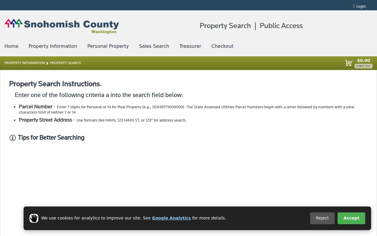
The search box makes the key limit clear: a known address or parcel works, while a person's name belongs in another index.
A second county route, the Real Property Sales Search, can filter transfers by city, ZIP, neighborhood, property use, sale date, price, and other property traits.
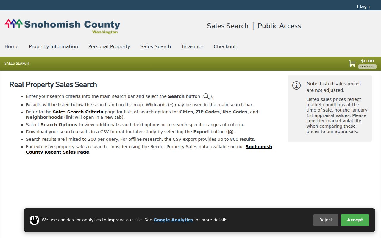
The results page displays no more than 200 matches, while CSV export can return up to 800. Sale prices are not adjusted for time, so use this as a street-comparison lead and confirm the recorded deed.
Three Mukilteo Address Keys
One address can appear three ways in a street directory search. Keeping them separate prevents false matches, especially when an owner receives tax mail elsewhere or an old street label has changed.
- Parcel
- The assessor's unique account for a mapped piece of real property.
- Situs address
- The physical property address, distinct from the taxpayer's mailing address.
- Plat
- A recorded survey that divides land into lots, blocks, roads, or condominium units.
- Criss-cross directory
- A directory arranged by street and house number so an address leads to a listed occupant.
The legal description is often the best bridge across time. It can survive a mailing change, an address correction, or a parcel split more reliably than a street phrase. Copy it exactly, then compare lot, block, subdivision, and parcel references across deeds.
Browse Mukilteo Blocks in SCOPI
SCOPI, Snohomish County Online Property Information, turns one parcel into a block-level view. Selecting adjacent polygons can reveal parcel ID, property address, city, ZIP, taxpayer, owner, acreage, market value, tax code area, neighborhood, and survey coordinates. Links can open the account summary, sales detail, or parcel map. The map is a finding tool, not a legal survey.
The Mukilteo Maps and GIS hub adds city layers for zoning, permits, parking, crime, historic maps, cemetery context, and imagery from 1941 through 2021. Its Power User Map and annexation history help explain why a parcel now called Mukilteo may once have appeared under county geography.
Question: Does clicking every parcel identify every resident? No. It inventories recorded parcel owners and property facts. Guests and other household members are not created by the map.
Follow Mukilteo Deeds by Street
The Auditor Recording Division holds deeds, deeds of trust, reconveyances, mortgages, contracts, liens, leases, plats, and surveys. Most recorded documents from July 1976 forward are searchable online. A free account has been required since March 2, 2026. Earlier material remains available through public terminals, microfilm, staff help, phone, or mail.
Start with the parcel ID from the assessor. The recorded-document system also accepts a party name, document type, ARN, date, book and page, or legal description. Parcel searches use the first ten digits under the county instructions. A grantor conveys an interest; a grantee receives it. Trace the current vesting deed back by searching the seller as an earlier grantee, then repeat while checking the same legal description.
The recorded-document categories are visible in the saved source image.
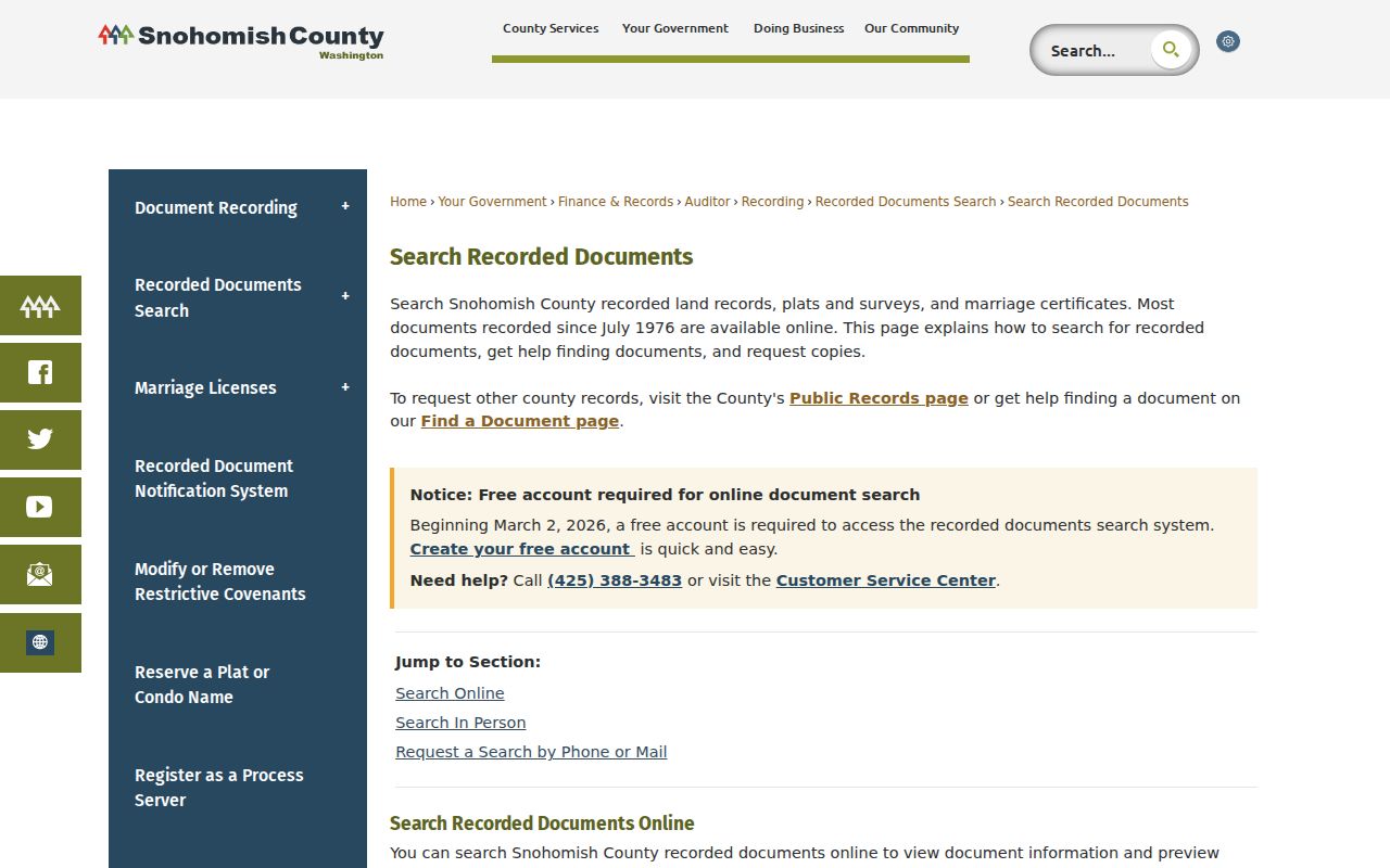
This view shows why one field is rarely enough. Names change and repeat, while parcel and legal-description fields keep a street search tied to land.
Mukilteo Streets Across Annexations
Mukilteo incorporated in 1947, and the city's queryable annexation layer includes year classes for 1947, 1965, 1968, 1980, 1991, and 2025. Each feature can carry an ordinance, effective date, population, area, year, and geometry. Those fields help test whether the city had custody of a permit or engineering file at the time in question.
A pre-annexation home may appear in Snohomish County sources even if its current mailing address says Mukilteo. Search both place names. Keep the parcel and legal description beside the address so changes in boundary, postal city, or street presentation do not break the chain.
The city's GIS collection displays the local mapping choices and disclaimer.
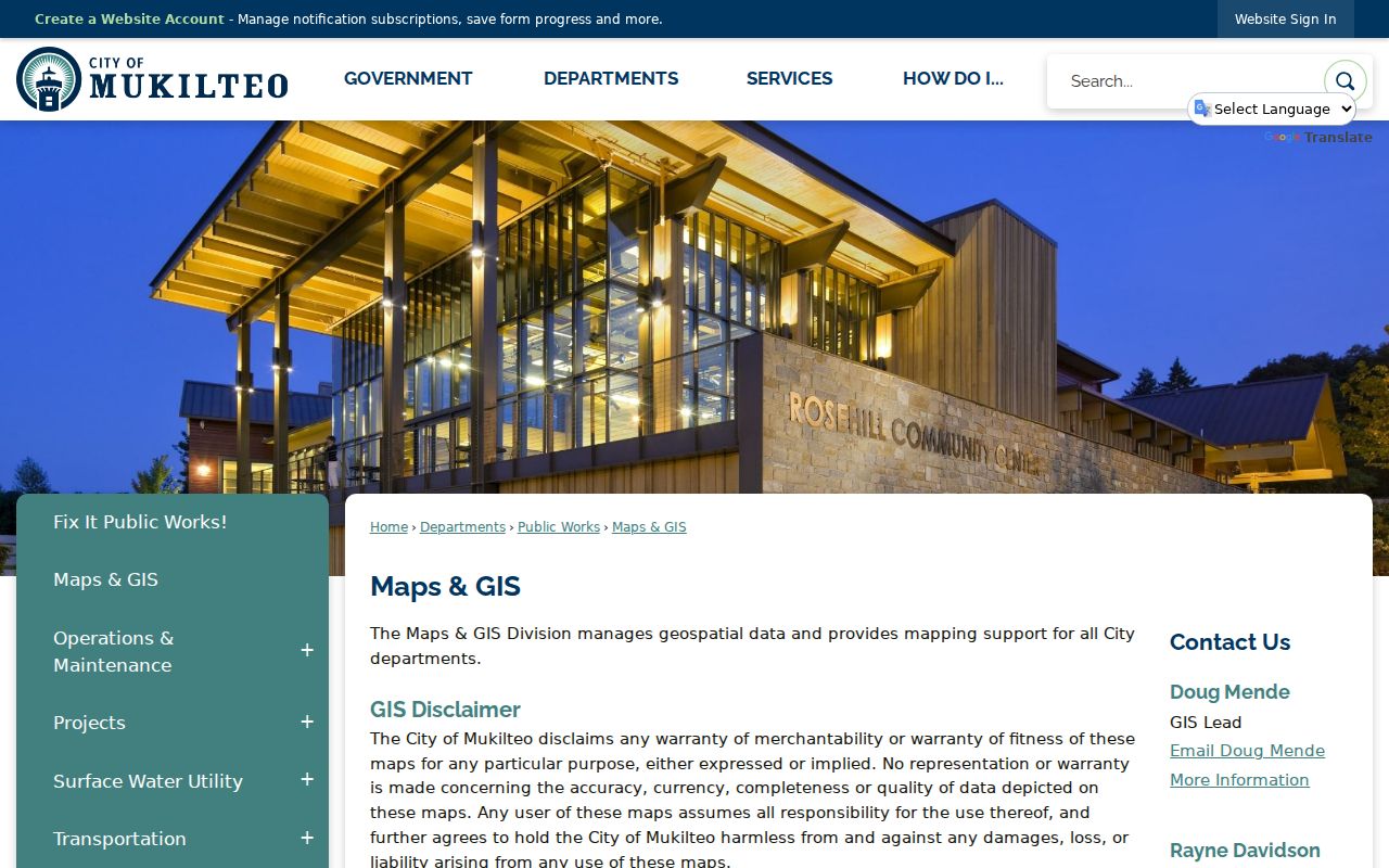
Use these layers as context, then confirm boundaries and ownership in the responsible agency's source record.
Check Mukilteo Permits by Address
Mukilteo's SmartGov public search accepts permit number, address, name, or contractor and offers Advanced Search and Map Results tabs. A permit may date construction, an addition, remodel, demolition, or code activity. It does not list a complete household, and the research did not establish the portal's full historical coverage.
If the portal does not return the needed file, send a narrow Mukilteo public-records request. Give the address or parcel, record type, date range, keywords, and any case number. The City Clerk coordinates Building, Community Development, Engineering, and Finance records, while police and fire have their own routes. The city provides an initial response within five business days and lists paper copies at $0.15 per page.
In 2025, Mukilteo received more than 1,000 permit applications and code-enforcement investigations nearly doubled, according to the 2026 State of the City speech. That workload supports a focused request instead of asking for all files on a broad street.
Mukilteo Records Indexed by Address
No single public list answers who lives along a whole road. These sources cover different parts of a Mukilteo street directory, with online, counter, request, and archive channels preserved.
| Address source | Custodian | Useful result | Access route |
|---|---|---|---|
| Property and tax account | Snohomish County Assessor/Treasurer | Parcel, situs, taxpayer, mailing address, values | Public Access, SCOPI, counter help |
| Parcel and city maps | County GIS and Mukilteo GIS | Adjacent parcels, zoning, annexation, imagery | Free viewers and city map hub |
| Recorded instruments | Snohomish County Auditor | Grantors, grantees, deeds, liens, plats | Online since July 1976; microfilm, counter, phone, mail |
| Public voter extract | Washington Secretary of State | Defined registration and address fields | Approved statewide CSV request |
| Permit and engineering files | City of Mukilteo | Project, permit, address, dates, applicant data where public | SmartGov or focused PRA request |
| Historical directories | State Library, SIGS, local repositories | Dated listed occupant by name or street | Library inquiry, appointment, archive search |
The parcel number ties maps, tax accounts, permits, and recorded instruments together. A street name can connect directory and voter evidence, but it is more prone to spelling and boundary errors. Preserve both keys and note when each record was current.
Mukilteo Voter Street Context
VoteWA verifies one voter with first name, last name, and date of birth. It is not a browseable household tool. For a larger lawful project, the Secretary of State handles the statewide voter-registration database extract as a delimited CSV after approval. The county form now directs database requests to the state, though county election maps are available for $20 each.
RCW 29A.08.710 allows a defined group of public fields, including name, address, political jurisdiction, gender, year of birth, voting record, registration date, and registration number. Washington does not register voters by party. Full birth date, driver-license or ID numbers, Social Security information, registration source, and original forms are withheld. Address Confidentiality Program and protected-record rules can replace or suppress an actual address.
That boundary corrects a common myth: voter data can provide dated street context, but it cannot lawfully expose every personal field or every person at an address.
Limits of Mukilteo Street Records
A parcel owner is not automatically the current occupant. Public sources do not form a full list of guests, children, or other members of a home. Utility customer data is not a public resident roll, and federal driver privacy law restricts personal address data from motor-vehicle records. A missing directory entry can mean unlisted, protected, absent from that edition, or outside its boundary, not an empty house.
City and county maps also warn that their lines are illustrative. Use a recorded plat or survey for legal boundaries. For personal research, retain only the source, date, and record identifier needed to support the finding. Do not repost bulk voter or address data.
Lawful use. Mukilteo address records may be used for lawful personal, family-history, property, and civic research. Washington law does not permit using public data to stalk, harass, threaten, or intimidate another person.